FEWS NET researchers at NASA, NOAA, USGS and USAID have been using products from the NASA LIS team to track record low snowfall conditions and above average temperatures across Afghanistan. This year was expected to be below average given La Nina conditions that have persisted from November to present. See NOAA blog on typical La Nina (note low precip and high temperatures expected over central Asia).
Last year started off with similar conditions, but snow pack caught up with record snowfall in February (see NASA Earth Observatory story from last year https://earthobservatory.nasa.gov/IOTD/view.php?id=89674). Now we are observing the record low snowpack:


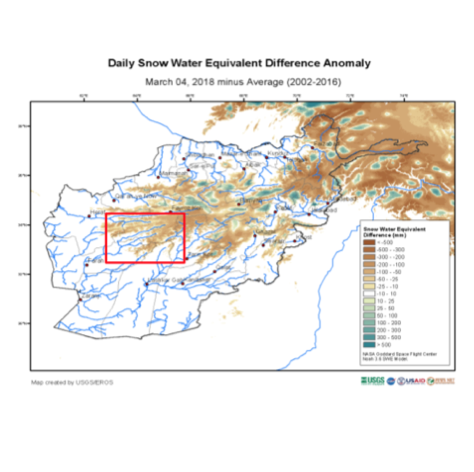
Figure 1. Snow water equivalent plot from LIS website (https://lis.gsfc.nasa.gov/projects/fewsnet-central-asia-lis7)
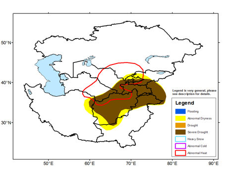
Figure 2. Central Asia Weather Hazards Report from CPC NOAA/FEWS NET (http://www.cpc.ncep.noaa.gov/products/international/casia/casia_hazard.pdf)
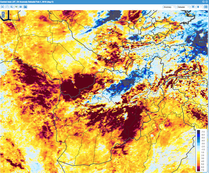
FEWS NET is also tracking record high temperatures (see red polygon in Figure 2). See MODIS Land Surface Temperatures:

Figure 3. Land surface temperature anomalies from https://earlywarning.usgs.gov/fews/ewx/index.html?region=casia
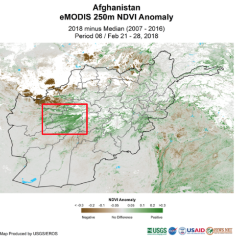
Another interesting feature that has not recently been seen is that NDVI anomalies are positive, which may be counterintuitive during drought conditions; however, at this time of the year, these areas are typically covered in snow. Therefore, the high NDVI is an indication that vegetation is showing coinciding with record low snow cover. This does not bode well for snow-melt derived water resources that are used for irrigation and crops in the spring/summer.


Figure 4. SWE anomalies and NDVI anomalies. NDVI anomalies are positive because this area is typically covered with snow.
FEWS NET is watching the situation (From January): http://www.fews.net/central-asia/afghanistan/key-message-update/january-2018
"Cumulative precipitation for the ongoing October 2017 – May 2018 wet season has been well-below average through late January, with estimates indicating less than 25 percent of average precipitation in much of the country. The ongoing La Niña increases the risk for below-average precipitation during the remainder of the season. Near-surface air temperatures throughout the winter months (December – March) are expected to be above both the long and short-term averages. This is likely to have an adverse impact on snow accumulation in mid-elevation areas. Below average precipitation and above-average temperatures are likely to lead to below-average snow water equivalent in most basins."
UN is watching the situation: https://www.tolonews.com/afghanistan/un-concerned-over-possible-drought-afghanistan
“lack of rain and snowfall this year threatens the grasslands and agriculture sector in the country”. "U.N. says in case of drought, Afghanistan will need 1.5 million tons of wheat".
Water resource management implications:
This news report says that the low rainfall (drought conditions) has led to a surge in privately dug wells that will divert typical flows over recent years https://iwpr.net/global-voices/private-wells-siphon-afghanistans-water.
Submitted by Amy McNally, Jossy Jacob, NASA LIS team, FEWS NET

